
For over 30 km (20 miles) along the North Island Main Trunk (NIMT) railway line, the Ongarue River generally flows adjacent to the railway embankment, and has caused many erosion and slope stability concerns at various locations. The purpose of our recent assessment was to aid KiwiRail in prioritising implementation of river–stabilization measures to increase the NIMT’s long-term resiliency. In the study area, the Ongarue River is approximately 30 m (100 feet) wide and characterised by large meanders cutting through pasture-converted floodplains. The maximum recorded flowrate in the river is approximately 570 cubic meters per second (20,000 cubic feet per second).
ENGEO performed a detailed study, topographic survey, site assessment, hydraulic modelling, and slope–stability modelling to determine specific risk ratings for 25 locations of concern. Based on the risk level for each location of concern, we provided recommendations including visual and automated monitoring; “soft” non-engineered remediation solutions such as reducing train speeds, installing fences to limit grazing and riverbank erosion, and planting deep-rooted vegetation; and engineered remediation solutions such as rip rap rock along the riverbank, tied-back H-beam and concrete–lagging retaining walls, and palisade walls (buried reinforced concrete piles).
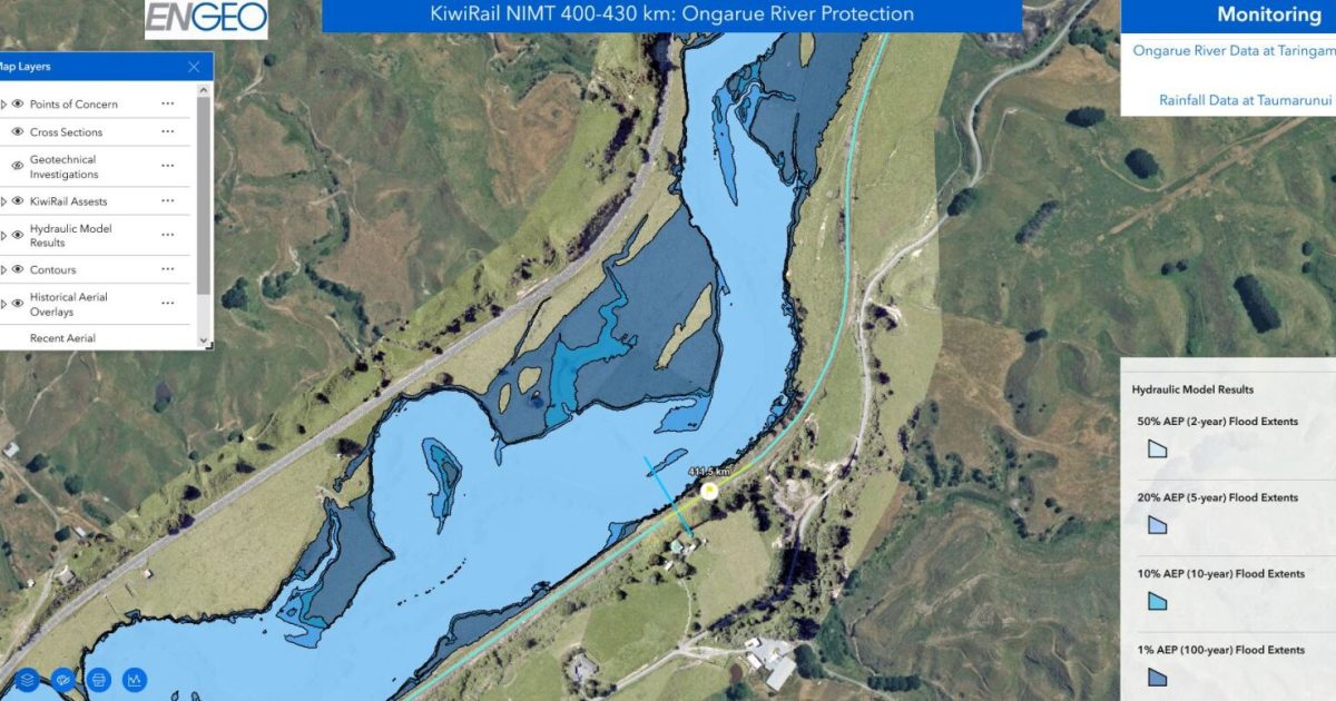
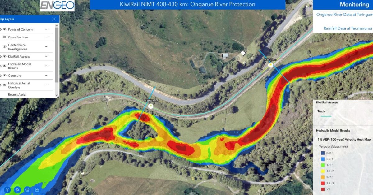
Given the high number of sites over a large geographic area, ENGEO created a GIS web portal to display locations of concern, survey data, aerial photographs, flood limits, KiwiRail assets, previous geotechnical investigations, and other relevant site information. Each location icon on the GIS web portal can be clicked to view its associated risk level, recommendations, site characteristics, and site photographs. Flood modelling and slope-stability reports for each location can also be viewed in the GIS web portal.
The GIS web portal provided the client with a more user-friendly interface compared to reading through hundreds of pages of traditional reports. While ENGEO did provide a report to the client to document our methods and analyses, the client used the GIS portal as the primary means for reviewing the flood modelling results, photos, and site observations. The project managers at KiwiRail were impressed with the ease and functionality of the GIS portal and thought it would be a great tool to include on many of their other projects across New Zealand. ENGEO’s ability to quickly create online GIS portals has improved our ability to communicate spatial information and engineering solutions with our clients.
Due to the relatively remote location of the railway line, steep terrain, and proximity to the river, construction of potential remediation solutions will be challenging. ENGEO performed a Multi-Criteria Analysis (MCA), which included considerations regarding resiliency, constructability, cost, effort to consent / permit, and historical issues in order to help KiwiRail prioritise which high-risk sites to stabilize first.